Rivers and Streams, and Waterfalls (some background helps for the new Pathfinder Honors)
(last updated September 18, 2013)
What is a River?
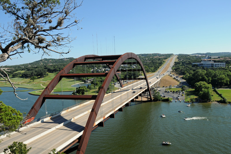
What is a river? A RIVER is a large stream, of course. Not helpful? Lets begin with the whole idea of moving water. Rivers are bodies of water flowing in a single direction (downhill), normally emptying into a large body of water like a sea or ocean. In the United States, there is a roughly north-south line along the peaks of the Rocky Mountains known as the CONTINENTAL DIVIDE. This line marks the delineation between waters that flow west toward the Pacific Ocean, and those that flow south or east toward the Gulf of Mexico or the Atlantic Ocean. All of the major rivers in Texas are of course on the east side of the Continental Divide. The Colorado River (the Texas Colorado, not its more famous western cousin) runs through the middle of Austin (where it is called Ladybird Lake or Town Lake). Further upstream, the Colorado River has several reservoirs and "lakes" created by dams, together called the Highland Lakes. These include, in order, Lake Buchanan, Inks Lake, Lake LBJ and Lake Marble Falls. Between Marble Falls and Austin come Lake Travis and Lake Austin. You can download a map of the Highland Lakes at the LCRA website, as well as a map of the dams that created these lakes. Each new Pathfinder year, the SAIL Club's first service project is taking part in the Lake Travis Underwater Cleanup, just one of many ways to help keep our rivers clean.
Creeks, Brooks, Rills and Rivers
So, where does a river start? Where a river begins, it is called the HEADWATER. Headwaters can stem from lakes, springs or snowmelt, from rainfall or groundwater. As water begins moving toward its destination, small trickles of water, usually from run-off, can erode tiny grooves or channels in the soil, called RILLS or RIVULETS. As the waters begin to come together, they form small moving bodies called BROOKS or CREEKS (or CRICKS, depending upon your preferred pronunciation). We have several very pleasant creeks to walk along in and near Austin, including Shoal Creek and Bull Creek. Brooks and creeks are basically the same thing, depending upon who is doing the naming. The general term for this moving body of water is a STREAM, but again, size is really determined by who is doing the naming, and what is around to compare it to.
Some consider brooks smaller than creeks, but either way, they are generally the smallest relatively consistent branch of the drainage system in a WATERSHED. The watershed is the area of land that empties into a single drainage basin, so pretty much the land that, as rain runs off or soaks into the ground, feeds ultimately into the same river. As the brooks or creeks flow, they may join together, or grow wider as they move downstream. When a brook or creek feeds into a larger stream or river, it is referred to as a TRIBUTARY. Rivers can also be tributaries of even larger rivers. The RIVER is the largest body of water flowing in a single direction, and usually emptying at its MOUTH into a large body of water like a sea or ocean (though as noted, it could empty into another river that ultimately empties into a sea or ocean.) Running right through Austin, as we noted above, is the Colorado River (not the major Colorado River out west, but Texas' own Colorado River). The Colorado is the longest river completely in Texas, stretching some 600 miles from Lubbock to the Gulf of Mexico southwest of Houston. If you look at the major river basins of Texas (you can find a Bureau of Economic Geology map at the LBJ Library website), and then travel to downtown Austin (map here), you will notice that the major north-south streets downtown are named after the Texas rivers. You will also see downtown that the city is flanked by two creeks flowing into the Colorado River: Shoal Creek on the west side of town, and Waller Creek on the east side of town. If you head out to one of the nearby Texas State Parks, chances are it is also built around a creek or river, a man-made lake or a natural lake. As you can see, rivers and streams are a very important part of Austin and Central Texas. River Ecology - Life in the Riparian Zone
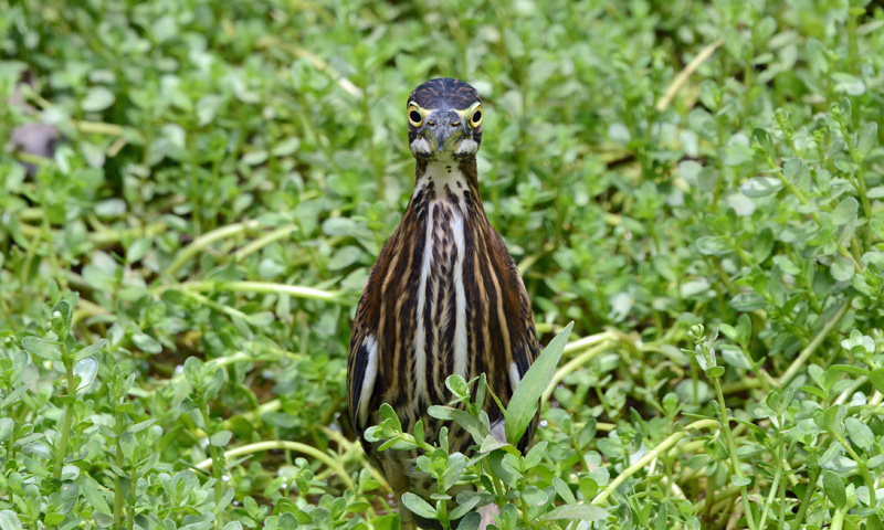
Rivers are not only about the water. They are teeming with life, both in the water and along the banks. The habitat along rivers is called the RIPARIAN zone, and there are many species of plants and animals you may see. Here in Central Texas, you may encounter Largemouth Bass, White Bass, Blue Catfish, Texas Shiners and even the occasional Alligator Gar. You may also see a common snapping turtle, the Texas cooter, the red-eared slider, the yellow mud turtle, and the pallid spiny soft-shell turtle. If you listen, you may hear a spotted cricket frog or a Strecker's chorus frog, you may see a big bullfrog, watch a blotched water snake swim by, or if you are lucky spot a Texas salamander. Fishing along the edge of the stream, you may see a green heron, or resting in the trees over the banks might be a double-crested cormorant, drying his oil-less wings, while flying overhead, an osprey may be seeking a fish. The cliff swallows are likely skimming the water surface, or fluttering along the bank collecting mud for their nests while the northern mockingbird sits on a limb nearby and serenades your journey. Your journey down the river is shaded by the tall cyprus trees, their knees jutting up out of the water along the shore. The broad leaves of the American sycamore also offer ample shade, and its bark is hard to forget. Along the bank of the river, the horsetails stick up, held stiff with silica, while a buttonbush hangs over the water with its round seed-balls attracting small birds. By the shore are numerous wildflowers, including the humorously-named frogfruit. Along the shore on the opposite bank, a white-tailed deer takes a drink from the stream, and in the mud on this bank you recognize the tracks of the American opossum and the raccoon. A gray squirrel leaps along the tree branches above your head, and as you pass under a bridge, you can hear the squeaks of a small colony of Mexican free-tailed bats, who will come out at dusk to feast upon all the mosquitoes and other flying insects.
On the last day, that great day of the feast, Jesus stood and cried out, saying, “If anyone thirsts, let him come to Me and drink. He who believes in Me, as the Scripture has said, out of his heart will flow rivers of living water.” But this He spoke concerning the Spirit, whom those believing in Him would receive; for the Holy Spirit was not yet given, because Jesus was not yet glorified. [John 7:37-39] 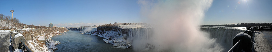
Waterfalls
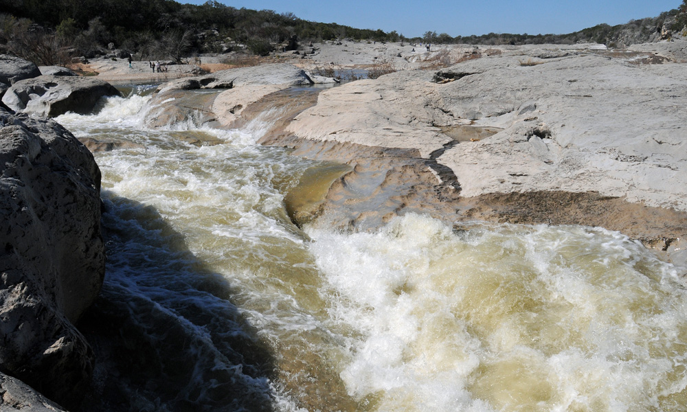
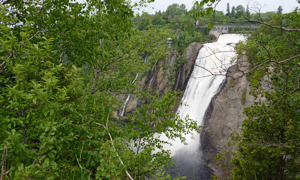
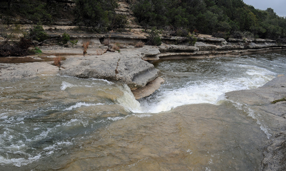
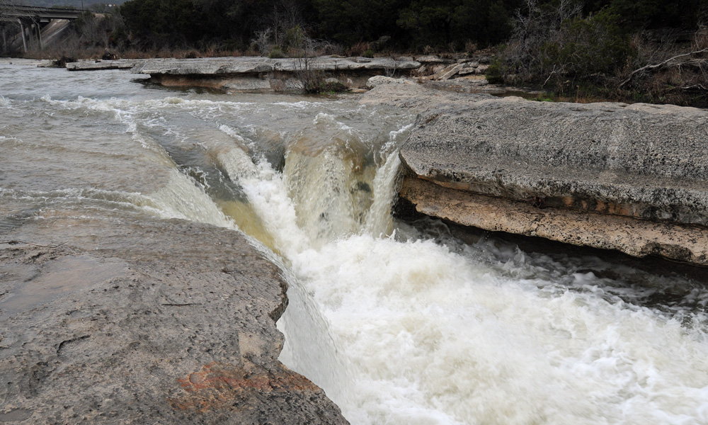
We’ve mentioned riffles, rapids and whitewater, but sometimes water has an even more dramatic experience as it flows down a river. Waterfalls are just what the name implies - places where water falls. Traditional waterfalls are formed due to irregular erosion of different rock layers. As the water flows over the surface, it begins to erode the softer layers of rock faster than the harder layers. This may cause the softer layers to cut back, creating a drop-off. In some cases (like at Hamilton Pool), it leaves an OVERHANGING LEDGE.
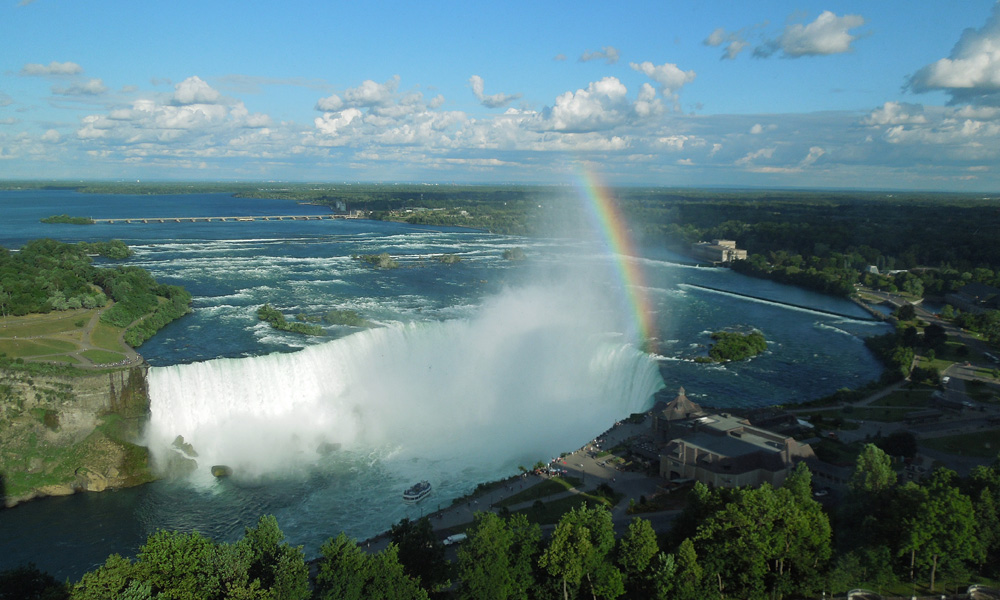
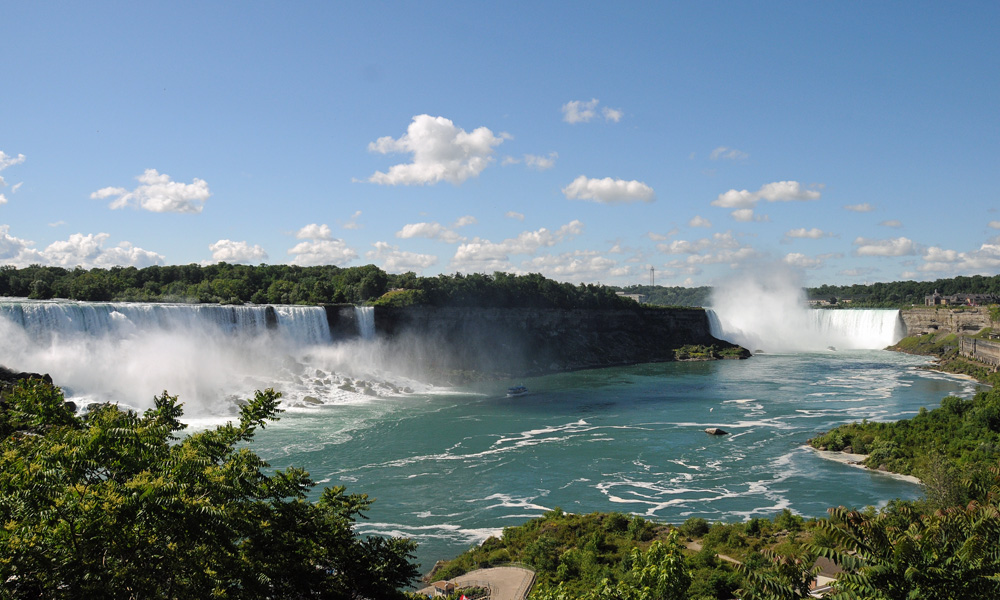
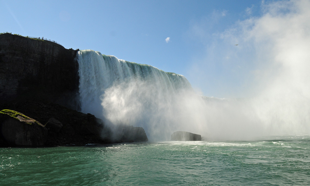
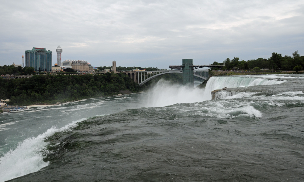
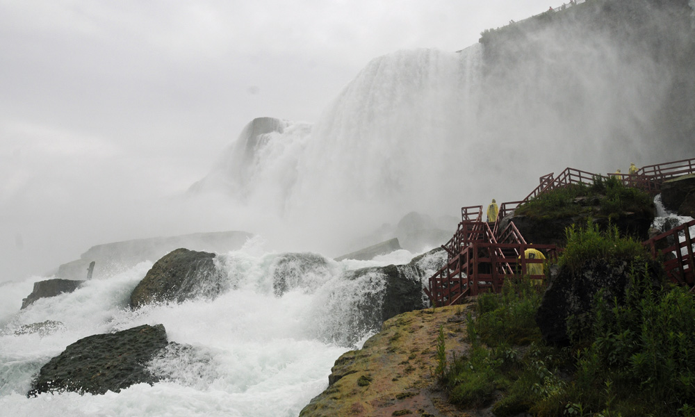
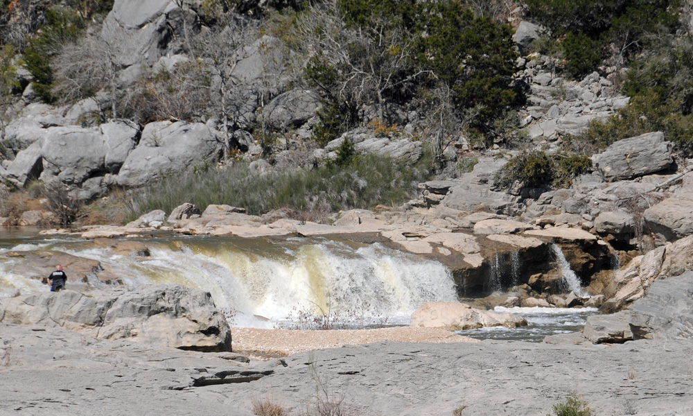
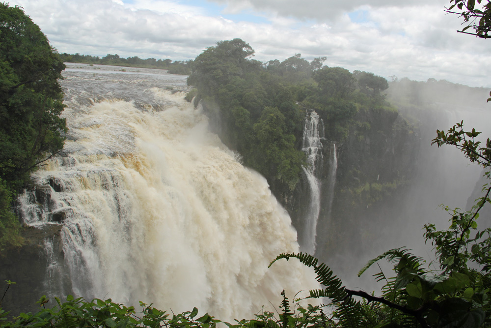
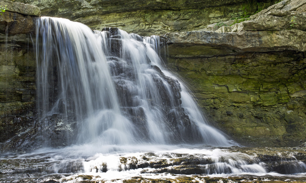
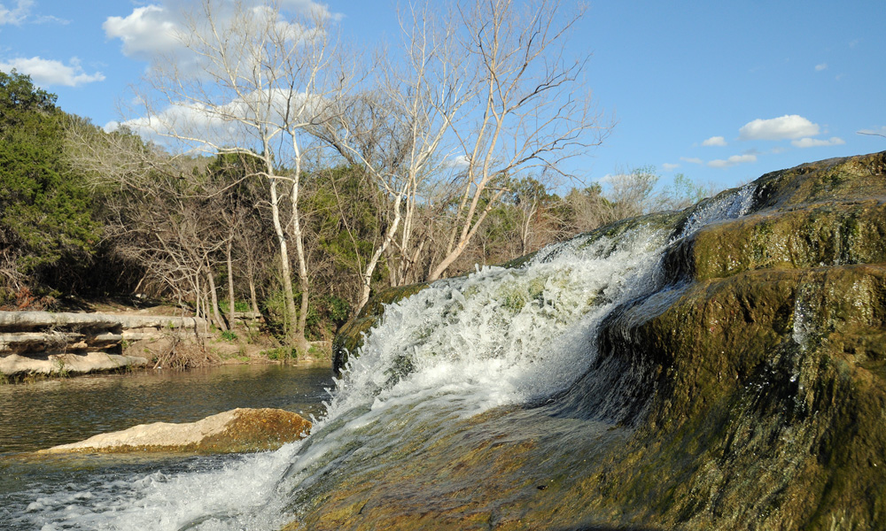
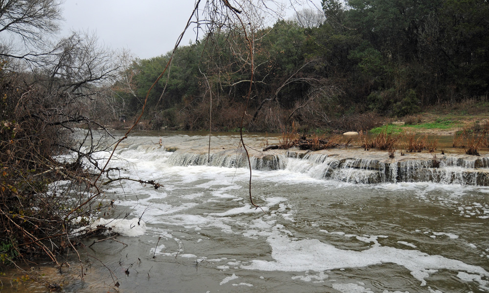
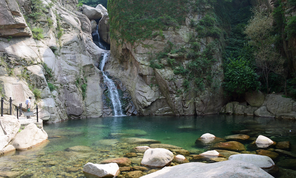
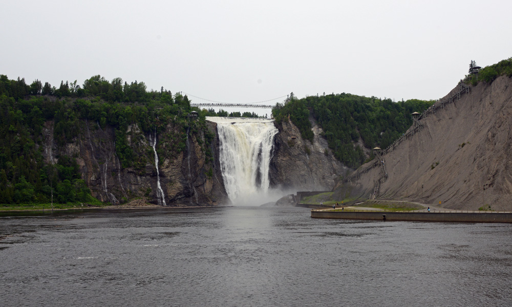
One of the most common forms of waterfalls are CASCADES. Cascade waterfalls don’t really fall as much as they seem to tumble down slopes or steps. As waterfalls shift to a more vertical drop, they may be classified as Plunge or Horsetail waterfalls. PLUNGE falls are what people often think of as waterfalls - the water doesn’t touch the rock face during its fall. HORSETAIL waterfalls, on the other hand, generally retain contact with the cliff face as they fall. Sometimes waterfalls are described by other features. TIERED waterfalls are those that appear to be made up of several waterfalls, one atop the other. SEGMENTED waterfalls are formed with rocks or other debris separate the flow of a river over a waterfall, splitting the waterfall. If two or more rivers fall over the same set of rocks aside one another, this is called a PARALLEL or TWIN waterfall. Another type of waterfall is a CHUTE waterfall, where the water runs through a narrow channel at high velocity. The lower falls at Bull Creek is a chute waterfall. If a wide river goes over the cliff, usually in a single broad sheet, it is called a BLOCK waterfall. These are usually wider than they are tall. There are several other types of waterfalls, and as you can see, these names are more descriptive than scientific. The slopes over which waterfalls fall can also be divided into two general categories; SCREE are sections of rock sloping up to 30 degrees, TALUS are steeper sections of cliffs, with a slope greater than 60 degrees. A waterfall may be more than one type, or may be characterized by the amount of water rather than the shape (a CASCADE, for example, is a very powerful waterfall, like Niagara Falls). But as we noted, the thing they all have in common is that the water “falls” down a slope or over a cliff. A Few Waterfalls - Can you identify the type?
River Explorers
Some rivers have well known explorers who traveled much of the river. Others saw several different explorers slowly unfolding different sections. Below are just a few of the explorers of major rivers in North America, as well as a few links to get you started in learning more information about them. Also, go to the library. There are numerous books on explorers or on these individuals.
St. Lawrence River - Jacques Cartier (1491-1557) Leading three official expeditions to North America for France in 1534, 1535 and 1541, Cartier explored the St. Lawrence River as far south as modern day Montreal. Cartier also gave Canada its name, drawing from the local Iroquois dialect.
Missouri River (and the Snake River and Columbia River) - Meriwether Lewis (1774-1809) and William Clark (1770-1838) Lewis and Clark explored much of the American northwest, beginning in St. Louis 1804 and heading up the Missouri River, crossing overland to the Snake River, down to the Columbia and the Pacific coast. They completed their trek in 1806.
Colorado River - John Wesley Powell (1834-1902) Powell, a one-armed explorer, traveled twice down the Colorado River, once in 1869 and again in 1871. During his life, Powell also climbed Pikes Peak with his wife (the first woman to climb the mountain), created a dictionary of the Ute language, and helped establish both the United States Geological Survey and the National Geographic Society.
Mississippi River (And parts of the Arkansas River) - Zebulon Pike (1779-1813) Pike, who never actually succeeded in scaling his eponymous Peak in Colorado, explored the Upper Mississippi River in 1805-06, followed by an expedition designed to explore the Arkansas and Red Rivers, though he only accessed parts of the Arkansas before being detained by the Spanish.
Yukon River - Robert Campbell (1808-1894) Campbell was a fur trader who explored the Pelly and Yukon Rivers in the 1840s and 1850s. Although Russian fir traders had explored much of the Yukon from the coast eastward, Campbell was the first white man to explore it in the other direction.
Ohio River and Mississippi River - Rene Robert Cavelier Sieur de La Salle (1643-1687) La Salle explored the lower Mississippi in 1682, claiming all of the Mississippi Basin for France, and naming it La Louisiane (later modified to Louisiana). La Salle had earlier explored portions of the Ohio River while seeking the elusive maritime route to the Far East. Here in Texas, he is perhaps even better known for his unfortunate navigational error that brought him to Texas instead of the mouth of the Mississippi.
Usumacinta - Teobert Maler (1842-1917) Maler, a German explorer and ethnographer, studied the Mayan civilizations and ruins in the Usumacinta River Valle in Mexico and Guatemala in the 1880s and 1890s (though he had done some previous explorations in Mexico prior to that time).
Platte River - John C. Fremont (1813-1890) Although not one of our major rivers, I include Fremont’s 1842 exploration of the Platte River Valley because every Pathfinder should be familiar with his name. It was stories about Fremont, nicknamed “The Pathfinder” after James Fenimore Cooper’s character Natty Bumppo, that A.W. Spaulding told tales of around the campfires of summer camps in California in the late 1920s. The name soon became attached to the camps, to various JMV societies, and ultimately to the worldwide Pathfinder organization.
There are several other explorers you may want to read about. Mackenzie River and Peace River - Sir Alexander Mackenzie (1764-1820)
Fraser River - Simon Fraser (1776-1862)
Columbia River - William Broughton (1762-1821)
Yukon River - John Bell (1796-1868)
Red River and Arkansas River - Thomas Freeman (? - 1821), Richard Sparks and Peter Custis (1781-1842)
Red River, Mississippi River, Sulphur River - Jean Baptiste Benard de La Harpe (1683-1785)
|
And he showed me a pure river of water of life, clear as crystal, proceeding from the throne of God and of the Lamb. In the middle of its street, and on either side of the river, was the tree of life, which bore twelve fruits, each tree yielding its fruit every month. The leaves of the tree were for the healing of the nations. And there shall be no more curse, but the throne of God and of the Lamb shall be in it, and His servants shall serve Him. They shall see His face, and His name shall be on their foreheads. There shall be no night there: They need no lamp nor light of the sun, for the Lord God gives them light. And they shall reign forever and ever. [Revelation 22:1-5] 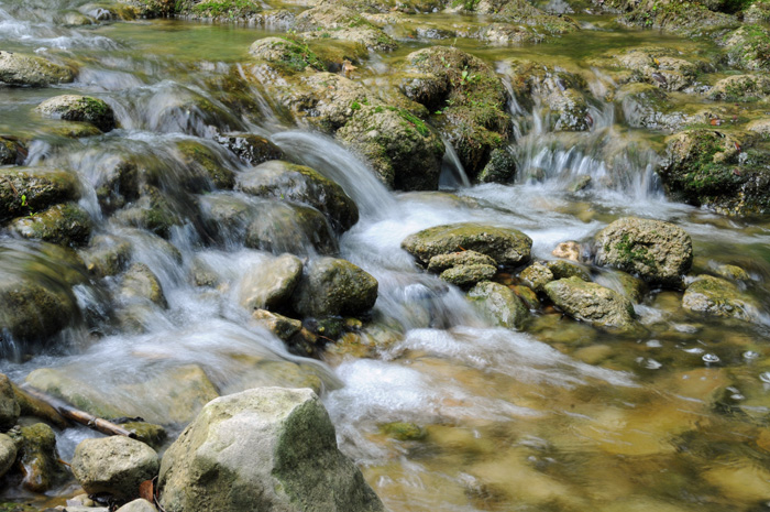
Rivers and the Land
The headwaters of a river are often characterized by relatively cold, clear and well-oxygenated waters, that are swift, carry little sediment and have fewer suspended nutrients. Near the mouth of a river, the waters are warmer, often filled with sediment and DETRITUS (decaying organic matter), and are relatively warm. The mouth generally has slower moving water than the headwaters, is murky and nutrient rich. The warmer, nutrient-rich waters support more algal growth in the waters. Fish like trout and salmon, and amphibians like salamanders often prefer the clear cool waters at the head of a river, while bottom-feeders like carp and catfish prefer the sediment-rich waters near the mouth.
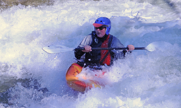
When a stream or river nears its end, its water is often flowing relatively slowly, allowing suspended sediments such as SILT (small particles of inorganic matter generally smaller than sand and larger than clay) to settle out along the bottom of the stream or river bed. If the river or stream overflows its banks, as during a flood, it deposits ALLUVIUM, soil, rocks and stones, and other sediments left above the normal water line. If a stream ends on land (such as a mountain stream that only flows with the melting of the snows or with floods), rather than into a river, its often slows and spreads out as the inclination of the ground down which it flows flattens out. This will leave and ALLUVIAL FAN, a fan-shaped pattern of sediments and other items dropped out along the ground. A DELTA is similar to an alluvial fan, but is formed where the river flows into the lake, sea or ocean, and the sudden slowing of the water allows the sediment to fall out as the water spreads, leaving a fan-shaped deposit plain. If a river empties into a semi-enclosed area of the Ocean or a salt-water sea, where the fresh and salt water meet is an ESTUARY. Estuaries are often very important nurseries for marine organisms, but they are also very susceptible to environmental changes and pollution. So what might the water look like as you float down a river here in Texas? Well, early on, you may see some RIFFLES in the stream; areas of relatively shallow water that flows rapidly in and among the rocks. If the water is a little deeper, and a little more turbulent, it is called RAPIDS, fast moving and often turbulent areas of water often with small falls and other minor obstacles. Kayakers, canoers and rafters often enjoy passing over various stretches of fast-moving water. Fast moving areas of water with relatively strong currents and often numerous obstacles are called WHITEWATER, and the foaming waters give a good reason for this name. For recreational users of these waters, a system of descriptions has been devised, which categorizes the various types of rapids or whitewater to let users know how difficult and dangerous a certain stretch of river may be. There are five categories of navigable whitewater (some include a sixth category, which is best avoided even by experts). Down at the bottom, Category I rapids are little more than riffles, with few if any major rocks or obstacles. At the other end, Category 5 rapids are often long, tumultuous, and have numerous obstacles and potential dangers. You can find more information about the classification system at American Whitewater. The picture below is of a Kayaker braving the white water on Barton Creek (yes, this is Barton Creek, after quite a bit of flooding back in early 2010).
As rivers flow, they scour channels into the earth. Fast-moving rivers and streams will often cut V-shaped channels, as they slice into the earth. Slow-moving broad rivers scour more U-shaped channels. Rivers rarely flow in a straight line. Rather, they meander, winding back and forth like a snake across the land. As rivers turn, the water on the outside of a bend has a higher velocity than the water at the inside of a bend. At first, this may seem odd - how can the water be going two different speeds at the same time? Well, think about when you are marching, and you have to do a column turn. Notice that the people on the outside of the formation have to take larger steps than those on the inside of the formation just to stay in an even row. The water is doing the same thing around turns (and interestingly, air does the same thing over the curved surface of a wing, with the faster-moving air above the wing creating a lower pressure zone that gives the wing lift). The faster water on the outside of the bend erodes the bank, while the slower moving water on the inside of the bend drops some of its sediments, making shallows and bars. The bend, then, is always moving. Sometimes, these MEANDERS wind around in a horseshoe shape, creating tight turns. As the water continues to flow, it erodes away the neck of land sticking into the river bend (think about the turn, and the way rivers erode on the outside of a turn). This process slowly eats away at the neck of land. Then, perhaps during a flood, the river breaks its bank, cuts across the narrowed neck, and begins flowing directly into the next stretch, bypassing the wide meander. As the river follows this new path, it may begin dropping sediments along the mouth of the meander, eventually cutting it off from the main flow of the river and leaving behind what is known as an OXBOW LAKE. (You can watch a brief video on meanders and oxbow lake formation)
What are the Major Rivers in North America?
There are really no definitive lists of the "major" rivers in North America. One could consider the total length of the river, or the role it plays in transportation, or in the size of the watershed, or the role in supplying water for agriculture or consumer use. If you look around, you will see many different takes on this question.
According to the U.S. Geological Survey (USGS), the fifteen longest rivers in the United States (not North America) in order are the Missouri River (2,540 miles), Mississippi River (2,340 miles), Yukon River (1,980 miles), Rio Grande River (1,900 miles), St. Lawrence River (1,900 miles), Arkansas River (1,460 miles), Colorado River (1,450 miles), Atchafalaya River (1,420 miles), Ohio River (1,310 miles), Red River (1,290 miles), Brazos River (1,280 miles), Columbia River (1,240 miles), Snake River (1,040 miles), Platte River (990 miles), and Pecos River (926 miles). The ten longest rivers in Canada (not counting the Yukon River, St. Lawrence River, Columbia River and even a tiny bit of the Mississippi that are in both Canada and the United States) are the Mackenzie River (1080 miles), Nelson River (1600 miles), Saskatchewan River (1205 miles), Peace River (1195 miles), Churchill River (1000 miles), South Saskatchewan River (865 miles), Fraser River (851 miles), North Saskatchewan River (800 miles), Ottawa River (790 miles), and Athabasca River (765 miles). The five longest rivers in Mexico (aside from the Rio Grande and Colorado that are shared with the United States) are the Usumacinta River (621 miles), Culiacan River (544 miles), Balsas River (479 miles), Lerma River (466 miles), and Grijalva River (373 miles). So, if we were to look at North America as a whole, the 15 longest rivers in order are the Mackenzie River (2635 miles), Missouri River (2,540 miles), Mississippi River (2,340 miles), Yukon River (1,980 miles), Rio Grande River (1,900 miles), St. Lawrence River (1,900 miles), Nelson River (1600 miles), Arkansas River (1,460 miles), Colorado River (1,450 miles), Atchafalaya River (1,420 miles), Ohio River (1,310 miles), Red River (1,290 miles), Brazos River (1,280 miles), Columbia River (1,240 miles), and Saskatchewan River (1205 miles). This, of course, is just a measurement of length. If we were to look at different features, we would get very different answers. If we were to look at average discharge, for example, the order changes to the Mississippi River [minus the Atchafalaya and Red River basin] (593,000 f3/s), St. Lawrence River [excluding the Great Lakes] (348,000 f3/s), Ohio River (281,000 f3/s), Columbia River (265,000 f3/s), Yukon River (225,000 f3/s), Missouri River (76,200 f3/s), Tennessee River (68,000 f3/s), Mobile River (67,200 f3/s), Kuskokwim River (67,000 f3/s), and Copper River (59,000 f3/s). Canada's top rivers (aside from those that cross borders) by discharge rate are the Mackenzie River (340,000 f3/s), Fraser River (125,000 f3/s), Slave River (121,400 f3/s), Koksoak River (99,000 f3/s), Liard River (86,400 f3/s) and Nelson River (84,000 f3/s). Mexico's rivers fall far short of these numbers in average discharge rates. Another way to consider rivers is by their watersheds. The Mississippi (not counting the Red River Basin) has a drainage area of 1,150,000 square miles. Next come the Missouri River (529,000 square miles), St. Lawrence River (396,000 square miles), Rio Grande River (336,000 square miles), Yukon River (328,000 square miles), Columbia River (258 square miles), Colorado River (246,000 square miles), Ohio River (208 square miles), Arkansas River (161,000 square miles) and Snake River (108,000 square miles). For Canada (aside from shared rivers), the largest are the Mackenzie River (697,000 square miles), Nelson River (344,500 square miles), Slave River (238,000 square miles), Saskatchewan River (129,700 square miles) Peace River (116,800 square miles), Red River (100,000 square miles), Churchill River (108,600 square miles), Liard River (107,000 square miles), and Fraser River (90,000 square miles). Mexico's rivers (aside from those that share borders) again fall far short of these numbers. Sources for data include:
United States Geological Society (http://pubs.usgs.gov/of/1987/ofr87-242/) Environment Canada (http://www.ec.gc.ca/eau-water/default.asp?lang=En&n=45BBB7B8-1) River Systems of the World (http://www.rev.net/~aloe/river/) Longest Rivers in Mexico (http://www.freebase.com/user/cbersch/views/longest_rivers_in_mexico) Longest Rivers in Canada (http://en.wikipedia.org/wiki/List_of_longest_rivers_of_Canada) So what are the major rivers in North America? As the above shows, that is a highly subjective list. However, the map below highlights several of the rivers mentioned above.

Threatened, Endangered, or Introduced
Rivers, like other habitats, are susceptible to changes that can threaten or endanger species, as well as to the risks associated with introducing non-native species. Below are some river species at risk, as well as some introduced invasives. You can read many accounts at the Texas Parks and Wildlife service’s information on rare, threatened and endangered species: http://www.tpwd.state.tx.us/huntwild/wild/wildlife_diversity/texas_rare_species/listed_species/
At risk (or worse) -- Barton Springs Salamander (Eurycea sosorum): A federally-listed endangered species, the Barton Springs Salamander is only known to live in fresh spring waters of Barton Springs in Austin, Texas. The salamander is small, just 2.5 inches long, is grey or pinkish with dark and light mottling, has very tiny eyes, and has red external gills. The salamander is endangered due to its very small habitat, and to pollution of the waters of the aquifer and springs. The City of Austin regularly monitors the Barton Springs Salamander population, and is taking active efforts to protect its habitat and waters, although this does not mean stopping swimming in Barton Springs Pool.
Blotched Gambusia (Gambusia senilis): The Blotched Gambusia (called the guayacon del Bravo in Mexico) is a small live-bearing fish with a dark lateral stripe and crescent markings (you can see the crescent markings in this image at the ARKive. Although still relatively abundant in Mexico, they are considered extirpated (all killed or removed) from their previous habitat in the Devils River in southern Texas, due to the construction of the Amistad Reservoir. In Texas, the Blotched Gambusia is listed as a threatened species, while globally the IUCN considers them a Near Threatened species.
Texas Fatmucket (Lampsilis bracteata): The Texas Fatmucket is a freshwater muscle that was once found throughout much of the upper Colorado River and its tributaries, but is now restricted to a few isolated populations. It is a relatively large freshwater muscle, reaching sizes of nearly 4 inches in length. The Texas Fatmucket is elongated, usually a greenish-yellow or tan and marked with dark brown wavy lines. Freshwater muscles have a specialized larval stage called a glochidia, which must attach to a specific host fish’s gills or fins, living the first stage of their life as a parasite. They are threatened due to habitat depletion and changes in fish populations. It is currently a candidate species for listing as threatened or endangered.
Introduced and invasives... There are many ways invasive species can find their way into our waterways. They may have been imported intentionally for food, for control of other organisms, for game or for display. They may have slipped past barriers from research facilities, or been released by individuals from fishtanks or for food. One of the challenges of non-native introduced or invasive species is that they often have no local predator, and thus can spread rapidly and outcompete the natives. Management may include introduction of other non-native species (which can cause another cycle of problems), by trying to catch them, poisoning, electrocuting, or other means of killing them. The best way to control invasives is prevention - do not release non-native species into the wild, and plant local species in your landscapes. NPR on top 10 invasive species in Texas: http://stateimpact.npr.org/texas/2012/04/13/the-top-ten-invasive-species-in-texas/ TexasInvasives.org: http://www.texasinvasives.org/ TPWD on exotic and invasive species in Texas waters: http://www.tpwd.state.tx.us/huntwild/wild/species/exotic/index.phtml Water Hyacinth (Eichhoria crassipes): Water Hyacinth is a floating plant with a large stalk of purplish flowers, somewhat resembling a hyacinth. The leaves are rounded or oval, with a slight bend in them, and the base of leaves are inflated, to allow the plant to float. A native of South America, the Water hyacinth can grow and spread very quickly, overtaking a pond, lake or even river. Water Hyacinth is often used as an ornamental in small ponds, and can from there escape into the wild. Management is primarily through removal, or the selective use of herbicides. From TAMU’s AquaPlants site: http://aquaplant.tamu.edu/plant-identification/alphabetical-index/water-hyacinth/ From University of Florida Center for Aquatic and Invasive Plants: http://plants.ifas.ufl.edu/node/141 From USDA National Invasive Species Information Center: http://www.invasivespeciesinfo.gov/aquatics/waterhyacinth.shtml Asian Clam (Corbicula fluminea): The Asian Clam is a small bivalve, with a yellowish or brownish shell marked by concentric ridges. They are now found in many of the river systems in Texas. Although they do not spread rapidly, and are now consumed by some native fish and crustaceans, the Asian Clam is considered a pest species, potentially transmitting foreign parasites to local waters, and fouling the pipes of power plants. From TexasInvasives.org: http://texasinvasives.org/animal_database/detail.php?symbol=18 From the USGS: http://nas.er.usgs.gov/queries/factsheet.aspx?speciesid=92 From USDA National Invasive Species Information Center: http://www.invasivespeciesinfo.gov/aquatics/asianclam.shtml Bighead Carp: (Hypophthalmichthys nobilis): A native of China, Bighead Carp can grow to nearly 100 pounds. They feed primarily on zooplankton and phytoplankton, are voracious eaters, and may out compete native fish for food. The eyes are located near the bottom of the head. Bighead Carp, like several other species of Asian Carp, are spreading throughout the United States, and there are currently efforts underway to try to prevent their spread into the great Lakes. From TexasInvasives.org: http://www.texasinvasives.org/animal_database/detail.php?symbol=11 From USGS: http://nas.er.usgs.gov/queries/factsheet.aspx?SpeciesID=551 From Fishbase.org: http://www.fishbase.org/summary/275 Rivers and Streams Honor
1. What distinguishes the rivers and streams biome from other aqueous biomes?
2. Define the following terms: Alluvial Fan, Alluvium, Brook, Continental Divide, Creek, Crick, Delta, Detritus, Estuary, Headwater, Mouth, Rapids, Riffle, Rill, Riparian, River, Rivulet, Silt, Stream, Tributary, Watershed, Whitewater. 3. Explain three differences in the water at the head and at the mouth of a river. Give examples of some different species found in each place. 4. Identify on a map the main rivers on your continent. Know at least 5 of their explorers. Read a story about one of the explorers. 5. What is an oxbow lake? Describe how it is formed. 6. List at least five fish that live in a river. 7. List at least five plants that live in a river or on a river’s edge. 8. List at least five birds that live on or near a river. 9. List at least five mammals that live in a river or at its edge. 10. Write a report or present orally the story of an introduced plant or animal species in this biome. Include where it came from, the problems it causes, and what steps are being taken to reduce/eliminate the damage. 11. Describe a species native to this biome, which is threatened, endangered or extinct. Include some contributing causes. 12. Sing a song about a river or stream. 13. Read about the “River of Life” mentioned in the bible. 14. Develop or read an object lesson about a river and tell it as pathfinder worship, children’s story, or other acceptable method of sharing approved by a Master Guide. 15. Do at least two of the following activities related to rivers and streams: a. Photograph or draw the organisms found in samples of water you collected from a stream. b. Walk along a stream and list as many plants and animals you observe. c. Visit a large waterfall or dam and explain what difficulty it presents for the wildlife. d. Pick up trash along a river or stream. e. Produce a 60 second commercial to inform an audience about something in this biome. (Honor Badge Image from investitureachievement.org) Waterfalls
1. Define the following types of waterfalls and give one example of each.
Block, Cascade, Horsetail, Plunge, Segmented, Tiered 2. Choose 10 waterfalls, including 2 from near the area or state in which you live, and list the following information about them: Name, Total Height, Waterfall Type, Watercourse, Location. 3. Complete two of the following activities. a. Visit a waterfall and write a paragraph telling about your experience. b. Choose a waterfall (other than ones in #2) of interest to you and record facts and interesting information about the falls that you have selected. c. Watch a video about a waterfall. d. Make a scrapbook about waterfalls. Include pictures of waterfalls and important information about each one. This may be a group project. e. Using the information provided, create a crossword or word search puzzle: Angel/Tallest waterfall in the world at 3212 feet. Browne/Tallest waterfall in New Zealand. Dettifoss/Waterfall flowing from a glacier in Iceland. Havasu/Waterfall on an Indian reservation in Arizona. Huangguoshu/Largest waterfall in China. Iguazu/275 falls on the border of Argentina and Brazil. Langfoss/Giant cascade in Norway, falling 2008 feet. Mardalsfossen/Well known tiered waterfall in Norway. Multnomah/Tiered waterfall along the Columbia Gorge in Oregon. Niagara/Most powerful waterfall in North America. Shomyo/Tallest year-round falls in Japan. Takkakaw/Cree Indian name for a waterfall in British Columbia. Tugela/2nd tallest waterfall in the world, found in South Africa. Victoria/Largest waterfall in the world. Yosemite/Popular tourist attraction in a National Park in California. Yumbilla/5th tallest waterfall in the world, 2nd tallest in Peru. 4. Water is mentioned in each of the following verses. Describe what is happening in each verse, then tell what the water symbolizes. John 9:11 John 13:5 Matthew 3:16 (Honor Badge Image from investitureachievement.org) |

All images by R. Baker unless otherwise noted